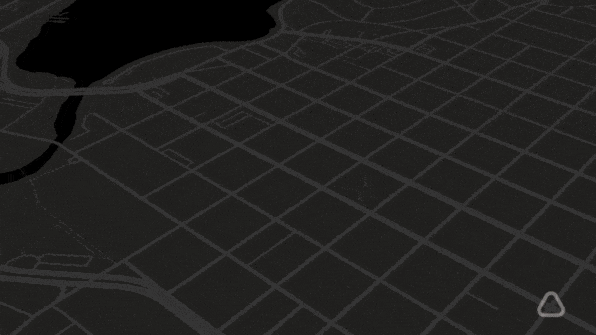
The google cars that drive around taking photos for Google Maps’ streetview are now equipped to measure something completely different. Two cars have been fitted with environmental sensors to track the air pollution of city streets. So far, the sensors have been tested out in Oakland, California, with an example of the resulting map below. The project aims to track pollution in many more U.S. cities and will make this data available to U.S. policy makers and nonprofits.
As Fast Company explains, the sensors show air pollution in much finer detail than the current air quality stations throughout the U.S. There are not nearly enough of the current stations to measure pollution on the micro level of block-to-block, but Google’s data shows how much pollution can vary just within this small distance. This data also breaks down the pollution into the varying components, such as black carbon, nitrogen oxide, and nitrogen dioxide.
- Log in to post comments

CRC Comments