|
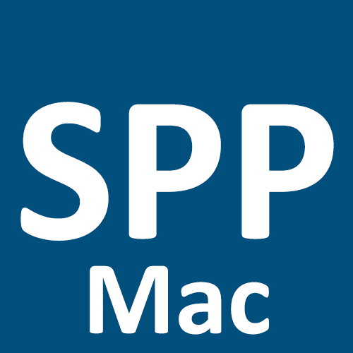
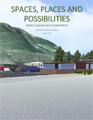
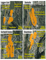
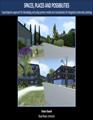
Visualizations were created that depicted the different community scenarios (i.e., ways the community can develop). Methods for building the visualizations involved a combination of mapping technology and video game development software, and they were developed as realistic, immersive virtual environments. Users can navigate the visualizations from the first-person perspective and toggle between (and compare) scenarios using keyboard commands. This is a demonstration video that shows a user exploring one of the visualizations and different community scenarios.
|
CLICK THE ICONS BELOW TO DOWNLOAD THE VISUALIZATION TOOLS
|
|
|
The Places, Spaces and Possibilities Squamish Visualization for Windows
Download the SpacesPlacesPossibilities-Squamish-WIN.zip package, unzip the package, and double-click Spaces Places and Possibilities.exe. A window will appear that gives you options for playing the visualization (lower 'Graphics quality' to increase performance of the application, if you find the visualization is not running smoothly). Click the 'Play!' button when you are ready to open the visualization tool.
|
|
|
The Places, Spaces and Possibilities Squamish Visualization for MacOS
Download the SpacesPlacesPossibilities-Squamish-MAC.zip package, unzip the package, and double-click Spaces Places and Possibilities.app. A window will appear that gives you options for playing the visualization (lower 'Graphics quality' to increase performance of the application, if you find the visualization is not running smoothly). Click the 'Play!' button when you are ready to open the visualization tool.
|
The visualization work done in this project builds on previous research, and it employed methods developed through Sidney Spit Visualization project.
|
|
DOWNLOAD PAPER
|
The Sidney Spit Visualization project developed a visualization of Sidney Spit Park (BC) and explored its potential as a tool for facilitating inclusive, participatory planning efforts. The visualization was built as realistic, dynamic virtual environment that can be navigated from the first-person perspective in order to evoke feelings of ‘being there’ in the coastal environment and connect with people’s sense of place. Management scenarios were built into the visualization, and users could explore these scenarios and think about the advantages and disadvantages of different park management options.
|
|
PUBLICATIONS AND PRESENTATIONS
|
|
Results from this research are disseminated through reports, presentations, and academic publications, and these can be accessed through the links below.
|
ARTICLES
Communicating complexity: Interactive model explorers and immersive visualizations as tools for local planning and community engagement, March 2021
|
|
Models that capture relationships between a variety of social, economic, and environmental factors are useful tools for community planning; however, they are often complex and difficult for diverse audiences to understand. This creates challenges for participatory planning and community engagement. Conducted in the community of Squamish (British Columbia, Canada), this study develops and examines tools for communicating outcomes of a community scenario modelling exercise to diverse stakeholders. These tools are (i) a “model explorer” and (ii) realistic, immersive visualizations. The model explorer is an online, HTML5-based tool that can be used to learn about the model, view community scenario maps, and explore potential outcomes of the scenarios. The visualizations are virtual environments that are navigated from the first-person perspective, and they were developed using a combination of ArcGIS, Trimble SketchUp, Adobe Photoshop, and the Unity3D game engine. A local government and community stakeholder focus group and public open house event were held to solicit feedback on the scenarios and tools. Findings of the research suggest that the two types of tools can be used in a complementary fashion, and tool integration can better harness their respective strengths in a manner that comprehensively communicates the implications of different development pathways to diverse community members.
|
Spaces, Places and Possibilities: A participatory approach for developing and using integrated models for community planning, July 2020
|
|
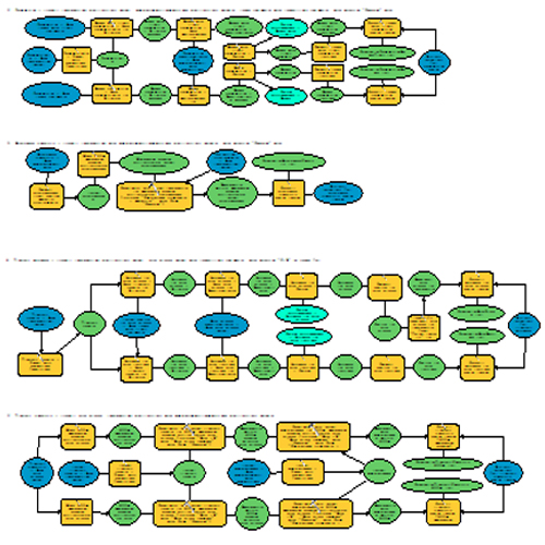
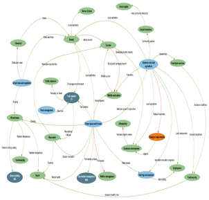
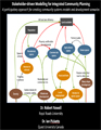
Integrated models can support community planning efforts because they have the ability to elucidate social, economic, and environmental relationships and outcomes associated with different local development plans and strategies. However, deciding what to include in an integrated model presents a significant challenge, as including all aspects of a community and local environment is unfeasible, whereas including too few aspects leads to a non-representative model. This research aimed to address this challenge by employing an iterative, participatory process in an integrated modelling effort. Conducted in Squamish (BC, Canada), the research involved developing a community systems model and scenarios (i.e., different community development patterns), modelling the scenarios, evaluating the model through a community focus group, and refining the model and scenarios based on the feedback. Much of the work developing the initial systems model and scenarios was done a previous research phase, and it involved assembling local government and community stakeholder focus groups to discuss issues and possible futures for Squamish. Analysis of the focus group data informed the design of a community systems model and local development scenarios, which were subsequently applied in an integrated modelling exercise. Modelling primarily used ArcGIS and R, and explored a variety of factors including access to amenities, education, walkability, parks/trails, food and farm systems, public transit, housing affordability, threats to critical habitat, etc. Another local government and community stakeholder focus group was held to solicit feedback on the model and scenarios, which were then refined based on the feedback. The research found the participatory approach to beneficial for creating community planning tools with high relevance to local contexts and needs. The model developed in this work has great potential for supporting community planning because it effectively identifies the co-benefits and trade-offs of different development strategies. It is important to develop these types of community planning tools through iterative processes, where they are refined through multiple stages of feedback by a variety of stakeholders, to better capture the local concerns and realities of a place.
|
Community systems models and development scenarios for integrated planning: Lessons learned from a participatory approach, May, 2020
|
DOWNLOAD PREPRINT
|
Systems models can support community planning, and by engaging local government and community stakeholders, these models can be designed to capture a comprehensive but manageable range of key interests, concerns, and values. This study explores a participatory approach for designing a community systems modeling exercise. The research involved convening focus groups of local government and diverse community stakeholders in Squamish, Canada, in order to discuss local issues and possible futures for the community. Focus group feedback was used to inform the development of a model of relationships between development paths (reflecting different densities) and multiple community outcomes, such as access to amenities and education, walkability, parks/trails, food and farm systems, public transit, housing affordability, and local employment. A participatory approach to modeling yielded many benefits, including alignment with normative participatory planning concepts, effective model scoping, accessing additional information sources, and enhancing local social capital and investment in the project.
|
Model explorer and visualizations, March 2020
|
|
This report details the development and evaluation of tools for communicating the outcomes of the Spaces, Places and Possibilities community scenario modelling exercise, namely an interactive model explorer and scenario visualizations. The report begins with a summary of the community-based approach used for modelling potential social, economic, and environmental outcomes of different development pathways, or scenarios, for the community of Squamish. It then describes two tools for communicating the outcomes and implications of the model and community scenarios: (1) a "model explorer" that provides an online interactive interface for engaging with the model, and (2) realistic, immersive 3D visualizations that are experienced from the first-person perspective. The final sections discuss feedback given on these tools by Squamish community members through a focus group and an open house event. The open house was held after the focus group, and the report also discusses how the focus group feedback informed refinements of the model explorer and visualization tools prior to the open house event.
|
Refining the systems model and community development scenarios, May 2019
|
|
This report discusses the refinement of the systems model and community development scenarios used in the scenario modelling process for the Spaces, Places and Possibilities research project. The report begins with a brief summary of the processes used for developing the systems model and scenarios and modelling the scenarios (more detailed discussions on the development and modelling processes can be found in previous reports). It then discusses feedback from a community focus group on the model, and how the model and scenarios were refined accordingly. The next section describes the refined model and scenarios, and it gives a sample of output produced from modelling the refined scenarios. The report concludes with a section on next steps for the research, specifically discussing the development of an interactive model explorer and scenario visualizations.
|
Summary of community systems modelling and focus group feedback, February 2019
|
|
This report discusses the community development scenario modelling process done in the Spaces, Places and Possibilities research project. The report begins with a brief summary of the systems model and community scenario development process (a more detailed discussion on this can be found in the previous project report). It then discusses the scenario modelling process and outcomes from this exercise, and describes outcomes from a focus group that was assembled to gain feedback on the modelling work. The report concludes with a section on next steps for the research, specifically discussing how focus group feedback will be used to refine the model and inform plans for visualization development.
|
Summary of systems model and scenario development, May 2018
|
|
This report discusses the process employed in the Spaces, Places and Possibilities research project for developing a systems model and defining a series of community development scenarios. It begins by identifying the major themes that emerged from the discussion and describing how these themes present considerations for scenario development. It then relates a model developed based on themes that emerged from focus group discussions; the model illustrates relationships between the different land-uses, strategies and community outcomes. Finally, the report describes the new/refined community development scenarios.
|
Spaces, Places and Possibilities: Summary of proposed research, February 2018
|
|
This report provides a two-page summary of the Spaces, Places and Possibilities research project and plan. The research involves a series of three focus group sessions, which convene local government and community stakeholders in Squamish. The first session informed the community development scenarios that are explored in the modelling and visualization phases of the project. The second and third session respectively focus on the outcomes of the scenario modelling and visualization activities.
|
PRESENTATIONS
A participatory approach for developing and using systems models and visualizations for integrated community planning, October 2019
|
|
This presentation outlines all three phase of the Spaces, Places and Possibilities research project. Conducted in Squamish (BC, Canada), the project employed a community-based participatory approach, and it consisted of three phases: (1) developing a community systems model and scenarios, (2) modelling potential outcomes of the community scenarios, and (3) creating tools for communicating the model outcomes and scenarios, namely a model explorer and interactive visualization (links to demonstration videos of these tools are included in the presentation). The research found the participatory approach to beneficial for developing community planning tools, and the main recommendation from this work is to develop these tools through iterative processes, where they are refined through multiple stages of feedback to better capture the local ‘reality’ of a place.
|
Using community participation, systems modelling and visualization for integrated planning and scenario exploration, March 2019
|
|
This poster provides an overview of all three phase of the Spaces, Places and Possibilities research project: (1) designing a community systems model and defining community development scenarios based on the ideas, values and concerns of local government and stakeholders, (2) using the systems model to calculate/estimate possible social, economic and environmental outcomes of different community development scenarios, and (3) creating tools for communicating scenario modelling outcomes to diverse audiences, namely an interactive interface for exploring model outcomes and realistic visualizations that are experienced from the first-person perspective.
|
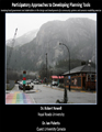
Participatory approaches to developing planning tools, January 2019
|
|
This presentation shares research involving a participatory approach to a community systems and scenario modelling exercise. Local government and community stakeholder focus groups were assembled to discuss local issues and possible futures for Squamish. The outcomes of the focus groups were used to development a systems model and a series of community scenarios, which were subsequently applied in a scenario analysis. Finally, another focus group was assembled to solicit feedback on the scenario analysis and its usefulness for local planning.
|
Stakeholder-driven modelling for integrated community planning, September 2018
|
|
This presentation shares a participatory approach for developing a community systems model and development scenarios. The research involved assembling a focus group representing diverse sectors/interests in Squamish, BC, to discuss local issues and possible futures for the community. Focus group data were analyzed using NVivo, resulting in a series of considerations that informed the development a systems model. The model can serve as tool for integrated planning by guiding investigations into possible outcomes associated with developing the community in different ways.
|
 Rob Newell (Principal Investigator) is an Adjunct Professor and was a Banting Postdoctoral Fellow with the School of Environment and Sustainability at Royal Roads University. He is leading the Spaces, Places and Possibilities research project, which explores the use of systems modelling and visualization techniques to capture and convey potential outcomes of social and physical infrastructure decisions to local government and stakeholders. Rob is also involved in community climate action research (MC3), leading projects on decomposition analysis and climate action co-benefits. His previous work has involved exploring different ways of engaging diverse groups in sustainability research and ideas, such as through data visualizations, social media, and animations. Rob has a PhD in Geography, and his doctoral research involved using video game development software to build a realistic interactive visualization of Sidney Spit Park (Sidney Island, BC) as a tool for participatory planning. Rob Newell (Principal Investigator) is an Adjunct Professor and was a Banting Postdoctoral Fellow with the School of Environment and Sustainability at Royal Roads University. He is leading the Spaces, Places and Possibilities research project, which explores the use of systems modelling and visualization techniques to capture and convey potential outcomes of social and physical infrastructure decisions to local government and stakeholders. Rob is also involved in community climate action research (MC3), leading projects on decomposition analysis and climate action co-benefits. His previous work has involved exploring different ways of engaging diverse groups in sustainability research and ideas, such as through data visualizations, social media, and animations. Rob has a PhD in Geography, and his doctoral research involved using video game development software to build a realistic interactive visualization of Sidney Spit Park (Sidney Island, BC) as a tool for participatory planning.
COLLABORATORS
 Ann Dale (Trudeau Fellow Alumna, 2004; Canada Research Chair, 2004-2014; Director, School of the Environment and Sustainability, Royal Roads University) is the head of the Community Research Connections program. Professor Dale, with her extensive background in public policy and government, brings a wealth of practical and theoretical knowledge to the team. Believing that both place-based and virtual communities are essential for solving modern day problems, she is deeply committed to expanding the public space for critical dialogue and asking the ‘right, hard’ questions. She currently leads and collaborates on several research projects. Ann Dale (Trudeau Fellow Alumna, 2004; Canada Research Chair, 2004-2014; Director, School of the Environment and Sustainability, Royal Roads University) is the head of the Community Research Connections program. Professor Dale, with her extensive background in public policy and government, brings a wealth of practical and theoretical knowledge to the team. Believing that both place-based and virtual communities are essential for solving modern day problems, she is deeply committed to expanding the public space for critical dialogue and asking the ‘right, hard’ questions. She currently leads and collaborates on several research projects.
 Ian Picketts is a Professor of Physical Sciences at Quest University Canada. His research includes climate change adaptation in the city of Prince George, where he worked with a variety of partners to develop a climate change adaptation strategy and implement actions in policy and practice. One of his primary interests is exploring how to effectively communicate complex information so it can be applied in real-life. His current research focuses on how the impacts of climate change interrelate with the impacts of resource development in northern watersheds. Prior to Quest, Ian taught at UNBC, including courses in outdoor recreation, natural resources, and environmental planning, and once worked as a park ranger. In his spare time he is involved in cycling advocacy and energy development issues in northern BC. Ian Picketts is a Professor of Physical Sciences at Quest University Canada. His research includes climate change adaptation in the city of Prince George, where he worked with a variety of partners to develop a climate change adaptation strategy and implement actions in policy and practice. One of his primary interests is exploring how to effectively communicate complex information so it can be applied in real-life. His current research focuses on how the impacts of climate change interrelate with the impacts of resource development in northern watersheds. Prior to Quest, Ian taught at UNBC, including courses in outdoor recreation, natural resources, and environmental planning, and once worked as a park ranger. In his spare time he is involved in cycling advocacy and energy development issues in northern BC.
 Jaigris Hodson is a Program Head and Professor with the College of Interdisciplinary Studies, Royal Roads University. Jaigris Hodson’s research specializes in understanding how people interact with digital technologies, such as social media, and the content that is produced and shared using those technologies. She has published research in a wide range of academic publications and non-academic publications. Hodson has written on technology for the Huffington Post Canada and the Conversation Canada and is regularly asked to comment on technology stories for local and national media outlets. She is also a sought-after speaker, discussing technology trends and their impacts on industry with organizations as the Canadian Optometric Leaders Forum, Social Media Camp and the Canadian Country Music Awards. Hodson is currently working on two Social Sciences and Humanities Research Council funded research projects. The first examines the ways we can use digital curation to help Canadians better access the work of researchers and the second looks at the experiences of female scholars who have been subjected to online bullying. Jaigris Hodson is a Program Head and Professor with the College of Interdisciplinary Studies, Royal Roads University. Jaigris Hodson’s research specializes in understanding how people interact with digital technologies, such as social media, and the content that is produced and shared using those technologies. She has published research in a wide range of academic publications and non-academic publications. Hodson has written on technology for the Huffington Post Canada and the Conversation Canada and is regularly asked to comment on technology stories for local and national media outlets. She is also a sought-after speaker, discussing technology trends and their impacts on industry with organizations as the Canadian Optometric Leaders Forum, Social Media Camp and the Canadian Country Music Awards. Hodson is currently working on two Social Sciences and Humanities Research Council funded research projects. The first examines the ways we can use digital curation to help Canadians better access the work of researchers and the second looks at the experiences of female scholars who have been subjected to online bullying.
COMMUNITY PARTNER
 The District of Squamish is located at the northern tip of Howe Sound, mid-way between the City of Vancouver and the Resort Municipality of Whistler. The community is situated within the traditional territory of the Squamish Nation and within the boundaries of Electoral Area D of the Squamish-Lillooet Regional District. Recognized as the Outdoor Recreation Capital of Canada, Squamish offers world class hiking and mountain biking trails, rock climbing, kite boarding, wind surfing, kayaking, ski touring, snowmobiling along with countless other outdoor activities. One of the fastest growing communities in Canada, Squamish offers a breathtaking natural setting, convenient access, vibrant arts and culture scene, range of education opportunities, affordable housing, and an expanding and diverse business community. The District of Squamish is located at the northern tip of Howe Sound, mid-way between the City of Vancouver and the Resort Municipality of Whistler. The community is situated within the traditional territory of the Squamish Nation and within the boundaries of Electoral Area D of the Squamish-Lillooet Regional District. Recognized as the Outdoor Recreation Capital of Canada, Squamish offers world class hiking and mountain biking trails, rock climbing, kite boarding, wind surfing, kayaking, ski touring, snowmobiling along with countless other outdoor activities. One of the fastest growing communities in Canada, Squamish offers a breathtaking natural setting, convenient access, vibrant arts and culture scene, range of education opportunities, affordable housing, and an expanding and diverse business community.
STUDENT RESEARCHERS
 Nate McCarthy is an undergraduate student at Quest University Canada studying urban geography and political economics. With strong and expansive experience in community leadership, advocacy, and communication, he is currently serving as the Quest University Students' Association President after spending the past year as an Editor-in-Chief for the university's student news magazine. Nate's academic focus is in the productive role of urban space through corporate finance and cross-sector integration. His undergraduate thesis investigates the influence of Amazon's corporate strategy and headquarter development on the Seattle metropolitan area and political autonomy. Nate McCarthy is an undergraduate student at Quest University Canada studying urban geography and political economics. With strong and expansive experience in community leadership, advocacy, and communication, he is currently serving as the Quest University Students' Association President after spending the past year as an Editor-in-Chief for the university's student news magazine. Nate's academic focus is in the productive role of urban space through corporate finance and cross-sector integration. His undergraduate thesis investigates the influence of Amazon's corporate strategy and headquarter development on the Seattle metropolitan area and political autonomy.
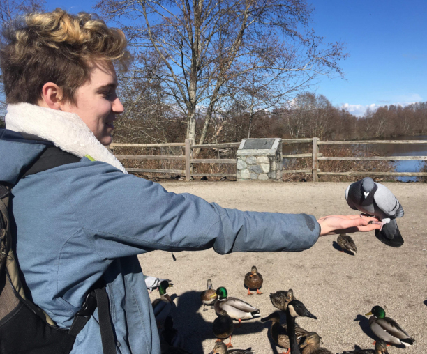 Melon Davis is an undergraduate student at Quest University studying ecology and wildlife biology. He is contributing to the visualization component of the Spaces, Places and Possibilities project in Squamish, working to provide an interactive model for community response to different community development pathways. He has a special interest in ornithology and the philosophy of human/non-human animal relationships. Academically he is still working on his senior thesis (titled a Keystone at Quest) on assessing the potential of thermal infrared cameras in surveying and monitoring wildlife. Melon Davis is an undergraduate student at Quest University studying ecology and wildlife biology. He is contributing to the visualization component of the Spaces, Places and Possibilities project in Squamish, working to provide an interactive model for community response to different community development pathways. He has a special interest in ornithology and the philosophy of human/non-human animal relationships. Academically he is still working on his senior thesis (titled a Keystone at Quest) on assessing the potential of thermal infrared cameras in surveying and monitoring wildlife.
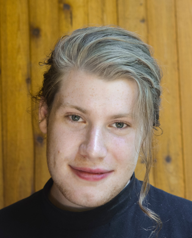
 Grace Hovem is an undergraduate student at Quest University where she studies a little bit of everything, but focuses on sociology, human geography, and political economy. For her thesis, she is taking a closer look at the role that cars play in shaping our built environments and societies. Grace has contributed to the development of the Model Explorer, and she a keen interest in this type of work because of the way the model outcomes exhibit the complicated cause and effect of development choices. Grace Hovem is an undergraduate student at Quest University where she studies a little bit of everything, but focuses on sociology, human geography, and political economy. For her thesis, she is taking a closer look at the role that cars play in shaping our built environments and societies. Grace has contributed to the development of the Model Explorer, and she a keen interest in this type of work because of the way the model outcomes exhibit the complicated cause and effect of development choices.
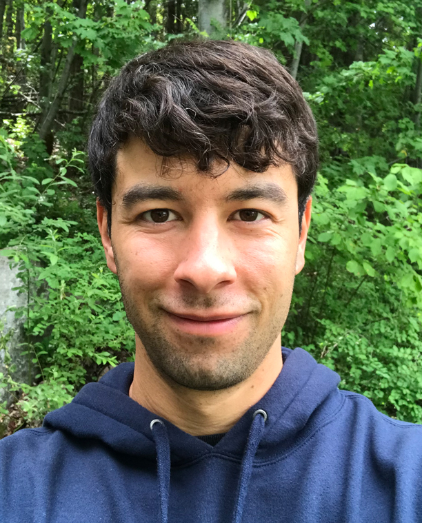 Stefan Navarrete joined the Spaces, Places, and Possibilities research project as a student researcher at Quest University Canada. While in university, he studied how the physical design and regulation of the built environment could be used to create healthy and diverse communities. For his undergraduate thesis, he created a conceptual design of a mixed-use affordable housing building as a way to address Squamish’s housing crisis. Having a strong interest in exploring how design can help improve the world around us, Stefan is continuing with this research by contributing to the visualizations of this project. Stefan Navarrete joined the Spaces, Places, and Possibilities research project as a student researcher at Quest University Canada. While in university, he studied how the physical design and regulation of the built environment could be used to create healthy and diverse communities. For his undergraduate thesis, he created a conceptual design of a mixed-use affordable housing building as a way to address Squamish’s housing crisis. Having a strong interest in exploring how design can help improve the world around us, Stefan is continuing with this research by contributing to the visualizations of this project.
|
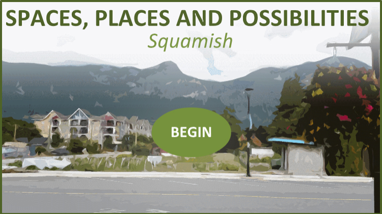
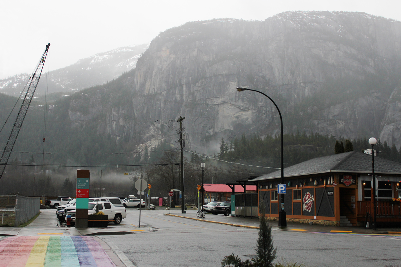 About this photo: Image of downtown Squamish at the intersection of Victoria Street and Cleveland Street (photo taken by Robert Newell)